


One of the challenges of moving to a new area is figuring out how to get around, especially when it comes to avoiding rush hour traffic or navigating public transit. Fortunately, once you’re able to understand the basic layout of the Palm Beach area, and the various transportation options available, getting to where you need to go efficiently becomes fairly simple.
THE LAY OF THE LAND
At nearly 2,000 square miles of land area (excluding its large portion of Lake Okeechobee), Palm Beach is only the second-largest county in the state (to Collier County in southwest Florida) – however, it’s also bigger than two states: Rhode Island and Delaware. Well over half of Palm Beach County, though, is made up of wetlands, the northern remnants of the Everglades, agricultural (especially sugarcane and vegetable) fields, and wildlife and water conservation areas.
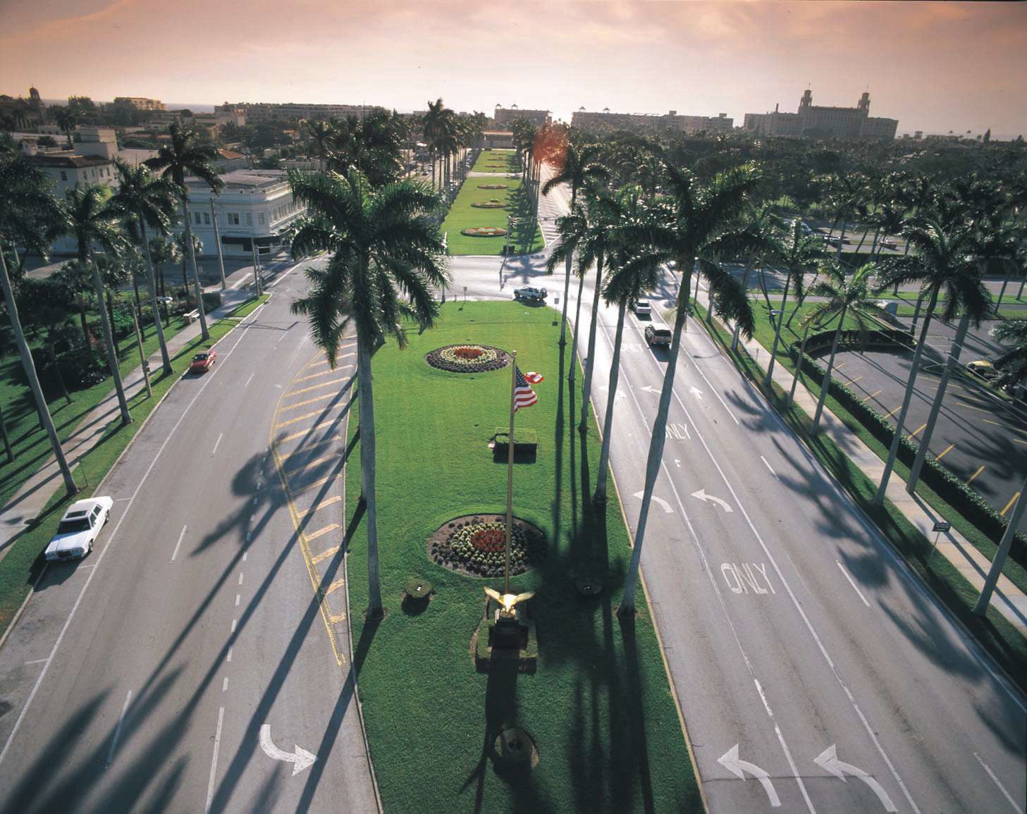
Most of the county’s roughly 1.4 million residents are concentrated along the 45-mile Atlantic oceanfront, commonly known as “the Palm Beaches” or the Gold Coast, where the transportation network is intricate and advanced and most people get around by car. More than 30 municipalities are laid out in a north-to-south line along the most heavily populated 15-mile slice inland from the coast. In the past several decades, though, more villages have popped up in the central-western areas, out to the natural demarcation point along State Road 80/U.S. 98 (most often called Southern Boulevard) that’s well-known as 20-Mile Bend. A few miles west of Wellington and Royal Palm Beach, that’s where urban and suburban Palm Beach County gives way to agricultural fields and the hour-long drive to the handful of smaller, rural communities surrounding the southeastern end of Lake Okeechobee.
Palm Beach County encompasses five general areas: Locals will tell you there’s north county, or all the cities from Riviera Beach north to the county line; central county or “downtown,” where the largest and oldest city, county seat and most common destination, West Palm Beach, is surrounded by a number of smaller cities; west-central county, where most new development is taking place; and the Glades, which is the area around the shores of Lake Okeechobee. Then there’s south county, the mostly built-out area south of Hypoluxo. West of Florida’s Turnpike, populous areas lying just east of the Everglades – inland several miles from coastal Boca Raton, Delray Beach and Boynton Beach – could constitute a city or two in their own right but never have incorporated. That region is also home to the county’s Agricultural Reserve Area, which is under heavy development pressure.Hypoluxo. West of Florida’s Turnpike, populous areas lying just east of the Everglades – inland several miles from coastal Boca Raton, Delray Beach and Boynton Beach – could constitute a city or two in their own right but never have incorporated. That region is also home to the county’s Agricultural Reserve Area, which is under heavy development pressure.
TRANSPORTATION ARTERIES
Living in any of those areas except the Glades is most convenient for people who work along Florida’s southeast coast. That is where the region’s two major controlled-access highways are: Interstate 95, a multilane freeway that runs the length of the East Coast, whose “missing link” north of PGA Boulevard in Palm Beach County was only completed in late 1987; and Florida’s Turnpike, a multilane divided toll road that spans 313 miles from its northern end at Interstate 75 in Wildwood to U.S. 1 in Florida City south of Miami, the gateway to the Florida Keys. I-95 has more than two dozen exits to major east-west roads in the county; the turnpike has eight full interchanges and two partial ones. Tolls on the turnpike average roughly 7 cents per mile but are discounted by about 25 percent for users of the SunPass electronic toll system, which works on all state toll roads and is being updated in 2016 to operate in a number of other states.
The state Department of Transportation makes navigating rush hours somewhat easier with electronic signboards on the interstate and turnpike that are used to alert drivers about delays and road closures due to accidents, construction, special events and other incidents. A special radio frequency broadcasts emergency messages. And WPTV-Channel 5, the local NBC station, has the county’s only traffic helicopter and runs regular reports during its morning and evening news programs, coinciding with the rush hours. The Department of Motor Vehicles also offers a system known as Florida 511, which is available via the Internet at www.FL511.com and via phone by dialing 511, which provides similar information for those planning a trip. Traffic cameras and estimated travel times are also accessible through Florida 511.
There are several other major north-south roads clustered near the Atlantic’s shores: State Road A1A, which hugs the entire Florida east coast and is the “main street” for the communities lining the barrier islands; U.S. 1, which runs from Key West to Maine, coinciding in places with A1A and elsewhere with what’s often called Federal Highway, which is just across the bridges spanning the Intracoastal Waterway from A1A; Congress Avenue (State/County Road 807); Military Trail (State/County Road 809); and, farther inland, State Road 7/U.S. 441, the main route for the county’s western suburbs. All of the last three are heavily trafficked commercial corridors. One road, commonly called the Beeline Highway (State Road 710), diagonally connects the coastal cities with communities to the northwest and on into Martin County, Palm Beach’s northern neighbor. It is being improved to service the growing, more rural communities in north county and points north.
Hundreds of bridges crisscross the Palm Beaches’ many waterways, including 20 drawbridges maintained by the state or county that span the Intracoastal. No tolls are charged, but sometimes bridge openings take a toll on easy commutes since their schedules vary. Some lift on boaters’ demand; others open at regular intervals, most commonly on the hour and half-hour.
OPTIONS FOR COMMUTERS
Palm Beach County is serviced by both Amtrak and Tri-Rail, the commuter railway operated by the South Florida Regional Transportation Authority, a consortium of counties, and running north-south from Mangonia Park (just north of West Palm) to Miami, right next to I-95 for most of the way. Tri-Rail runs trains every 20 or 40 minutes depending on the hour between 4 a.m. and 10:30 p.m. weekdays, and every hour on weekends between 5 a.m. and 11 p.m. Fares vary, and a variety of different passes also are offered. See a Tri-Rail map here.
The Downtown Trolley in West Palm Beach allows travelers to connect for free between the Amtrak/Tri-Rail station via its Green and Yellow lines with seven stops around the city, and a seasonal (fall-to-spring) Orange Line is also offered to take people to museums, gardens and other places downtown and on Palm Beach. The stations in Lake Worth and Boca Raton also have free shuttles to the downtown areas; taxis are available at others.
A controversial high-speed rail project called All Aboard Florida is under construction through the Tri-Rail/Amtrak corridor and is planned to connect new downtown stations in Miami, Fort Lauderdale and West Palm Beach sometime in 2017, with extended service to Orlando a year or so afterward, and to run a projected 32 trains per day. Communities along the Treasure Coast (Martin, St. Lucie and Indian River counties) have objected, however, to the company’s plans because they don’t include any stations between West Palm and Orlando, so that timeline may be in doubt.
The county’s public transit service, Palm Tran, connects commuters to every destination in the county, operates daily (except holidays) with 34 routes and serves more than 3,200 bus stops. Weekday peak service runs every 30 minutes; off-peak, every hour. Weekend service is hourly on most routes. Timed-Transfer points allow for easy switching from north-south main routes to the east-west routes, and the buses also serve several park-and-ride lots. There’s a paratransit division as well, called Connection, offering door-to-door service for senior and disabled citizens. Riders can plan their trips using a computer or smartphone and view the locations of buses in real time, plus maps and riders’ guides are available for free. Cash fares are $2 per bus ride for adults (no transfers allowed); half-price for seniors (65 or older), students (21 or younger with valid school ID) and those with disabilities. An all-day unlimited ride “QUIK Pass” may be purchased from drivers for $5; they’re also offered in a 31-day pass for $70. Reduced daily ($3.50) and 31-day ($55) QUIK Passes are also offered to qualifying individuals.
OTHER TRANSIT CHOICES
The Lyft and Uber car-hailing services are available via their smartphone apps in the county under a temporary operating agreement, as the Palm Beach County Commission decided last fall to wait and see if Florida’s Legislature enacts statewide regulations for these popular taxi alternatives rather than pass local rules. Local cab companies, which have pressured the county to make those services subject to the same sorts of rules that they must follow, are too numerous to list. There are three limited water taxi services in the county, Sailfish Marina Resort’s and the Peanut Island Water Taxi in Riviera Beach, and Admiral Water Taxi in Deerfield Beach. Bicycling is not a highly visible mode of commuting here, mostly because of crowded roadways, but some roads have been retrofitted with bicycle lanes and new roads must have them by state law. Also, Tri-Rail trains and Palm Tran buses have accommodations for bicyclist commuters.
WATER TAXIS
If you are looking for a fun way to see the beaches in Palm Beach County, or spend the day at the very popular, Peanut Island – than maybe a Water Taxi might be the way to go…
Sailfish Marina Resort on Singer Island (98 Lake Drive) operates the Palm Beach Water Taxi, which has 20-passenger covered vessels and 49-passenger Corinthian catamarans that travel to all areas of the Palm Beaches accessible through the Intracoastal Waterway. Narrated sightseeing “Now and Then” tours of Palm Beach are offered daily, as well as shuttles to Peanut Island, which has picnicking, swimming, snorkeling and camping facilities and is a very popular gathering spot during holidays and special events. The marina’s number is 561-844-1724 and its website is sailfishmarina.com; call 561-683-TAXI for reservations, which are strongly recommended.
Peanut Island Water Taxi, based at the Riviera Beach Marina, 200 E. 13th St., operates a boat rental service and is open 10 a.m. to 5 p.m. daily; call 561-844-7969 for information.
Admiral Water Taxi, which offers one-hour “Mansion Cruises” during fall and winter along the Intracoastal in south county, is located at Two Georges at the Cove Waterfront Restaurant and Marina, 1754 S.E. Third Court in Deerfield Beach; call 561-400-9054 or visit admiralwatertaxi.com for information. There are also several services based in Fort Lauderdale.
PUBLIC AND PRIVATE AVIATION
Palm Beach International Airport in West Palm Beach is the county’s premier portal for air travel (both via major airlines and general aviation aircraft), but visitors may find it less expensive to travel from or to Fort Lauderdale/Hollywood, Miami or Orlando international airports. Many car rental agencies are based at PBIA, but for other options such as cabs, shuttles and private transportation (utility vehicles or limousines), it might be easiest to go through Airport Transfers Southeastern Florida Transportation Group. Palm Tran bus service is available to take travelers wherever they need to go, including to transfer to Tri-Rail or Amtrak.
 There are three other airports operated by the county Department of Airports. The North Palm Beach County General Aviation Airport provides quick access to Jupiter, Palm Beach Gardens and the Florida Research Park, and is a reliever for PBIA but has no major airlines servicing it, accepting both jet and private aircraft. Palm Beach County Park Airport is in Lantana, 6 miles south of PBIA, and is also a reliever airport but does not accept jet aircraft. It is home to several flight schools. Palm Beach County Glades Airport is near Lake Okeechobee and is the county’s designated general aviation recreational and sport flying airport.


Facebook Comments